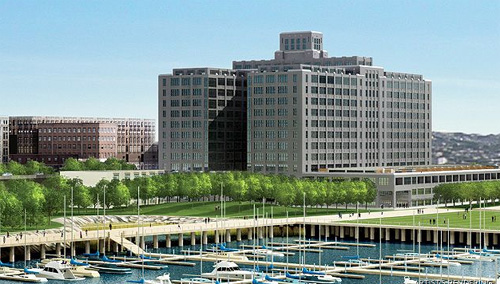
Brooklyn Papers reports on upcoming meetings regarding access to the "new" Brooklyn Bridge Park (artist rendering above):
How will you get to the development site commonly referred to as “Brooklyn Bridge Park”? Practice.
Local officials who are devising ways to get people to the proposed apartment and commercial project along the Brooklyn Heights and DUMBO waterfront will hold their second public meeting next week to seek public input.
The site — which is currently difficult to access — is likely to include some open space and areas that proponents tout as parkland.
“We encourage everyone to come out and help us explore options,” said Hank Gutman, chairman of the Downtown Brooklyn Waterfront Local Development Corporation, which is doing transportation studies and focus groups.
“Since the park stretches 1.3 miles, we want to make sure that visitors have a variety of ways to get there.”
Ways being discussed include a tunnel to Furman Street from the Clark Street subway platform, and trolley-styled busses from Borough Hall.
At the first meeting last month, planners announced that they were also considering a direct link from the fabled Brooklyn Heights Promenade at Montague Street to the development.
Such a link had been discussed in the past, but shot down by Heights residents who feared people tromping through their quiet neighborhood on their way to the waterfront development.
Brooklyn Bridge Park transportation study meeting, Dec. 4, 6 pm, St. Francis College auditorium (182 Remsen St.). For info, email bbp_transit_study@yahoo.com


Comments are closed.