Recap of BQE triple cantilever meeting

triple-cantilever

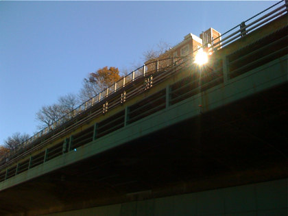
On Tuesday night, state Transportation Department engineers officially kicked off the two-decade reconstruction project of a 1.5-mile stretch of the Brooklyn-Queens Expressway that stretches from Sands Street to Atlantic Avenue and underneath our own Promenade.

The project will cost $295 million, with 80 percent of funding largely coming from the federal government and 20 percent from the state, said DOT spokesman Adam Levine.

Shovels won’t go into the ground until 2020 — yes, 2020, and not 2018 like engineers estimated last October — but project planning starts now, project manager Peter King told the 50 or so stakeholders who attended the meeting at Polytechnic University. Loosely quoting Churchill, he said, “We are nearing the end of the beginning.” (The timeline is available here.)

We’re getting a copy of the full Power Point presentation and will post it for you on Wednesday, but in the meantime, here are some highlights:

Update! Here’s the PowerPoint presentation: [pdf]

  • The current structure is “safe,” despite having outlived its 50-year lifespan, King said, and engineers may do immediate repairs on necessary elements, even as the overall reconstruction project is underway.
  • The actual work will be done in two phases. Engineers hope to have their final project design (known as the “Record of Decision”) for Tier 1 established by August 2012, and Tier 2 by mid-2015.
  • As for Brooklyn Bridge Park, King said: “We’ve met with the Brooklyn Bridge Park planners and we continue to meet with them because we recognize the importance of that project to the community and to the city at large.” How the reconstruction work can coexist next to the park remains one of the project’s main challenges.
  • The timeline is so extensive because of the specific and complicated nature of the project, and because it will take so many years to sort through the full environmental impact statement, interim projects, and analysis of alternative plans, King said. “Our commitment is to do this as quickly as we can, but as responsibly as we can,” he added.
  • And, lastly, engineers are still sorting out the exact dimensions of the project, like if it will include the entrance/exit ramps at Columbia Street and Atlantic Avenue. Those details will be ironed out as planning gets underway.

The agency set up a project Web site, where they will post “comprehensive minutes” form each meeting and regular updates at https://www.nysdot.gov/bqedowntownbrooklyn. The next public meeting will be on June 22 at Polytech in Downtown Brooklyn.

Stay tuned!
Share this Story:

,

  • Rob

    About time they get to this. Traffic there is terrible. That top cantilever, the under-used back door park should be used as a roadway for traffic to the bridges. The lower cantilever and middle cantilever should both be widened. The center cantilever could be used for express traffic, changing directions near mid day .

  • epc

    “back door park”? You mean the Promenade? The place that 1000s of people use every week? That park?

    The whole thing should be shut down, we can route the traffic through Manhattan.

  • nabeguy

    Rob? As in Robert Moses? Sure, let’s turn the Promenade into a highway. Brilliant idea. Oh wait, it only extends from Orange to Remsen. Doh!

  • No One Of Consequence

    Let’s return to the original Moses plan and run the BQE down Hicks Street.

  • Ari

    During the work period, why not just widen Furman street have traffic move in both directions, it connects perfectly from Atlantic to Old Fulton.

    Screw the Brooklyn Bridge Park, routing traffic through the entire heights neighborhood on Hicks would be a decade long epic shitshow.

  • Montague Mike

    If you read the Fed Highway Admin report from a couple of years ago, it’s clear the planners don’t expect to re-route the 160,000 cars daily through the Heights. There’s going to be some combination of Furman Street use and temporary roadway in the park. The problem for Heights residents (to take a NIMBY approach) is making sure there are appropriate closures made so unauthorized detours don’t turn Hicks, Henry and Clinton into parking lots.

  • Andrew Porter

    Current news says that the Arctic may be ice-free in summer as early as 2012, not the end of the century. My prediction for the BQE: the trench will be getting pretty wet at high tide by the time this project is finished.

  • the accountant

    Mike, the report you refer to was a brainstorming exercise. The real planning starts on June 22.

  • Montague Mike

    My point was, whether you read the “brainstorming” report or just look at the road itself, it’s clear that there are a limited set of options to re-reroute all of the BQE traffic during long-term construction. Though I’m sure some engineers wouldn’t think twice about sending the cars & trucks through the Heights if the streets could support the volume, it’s obvious that the streets can’t. So you’re left with various permutations of the existing BQE cantilevers, Furman Street and a temporary roadway (over the foregoing or over/in the park). They can brainstorm all they want but there are only a few pieces in play.